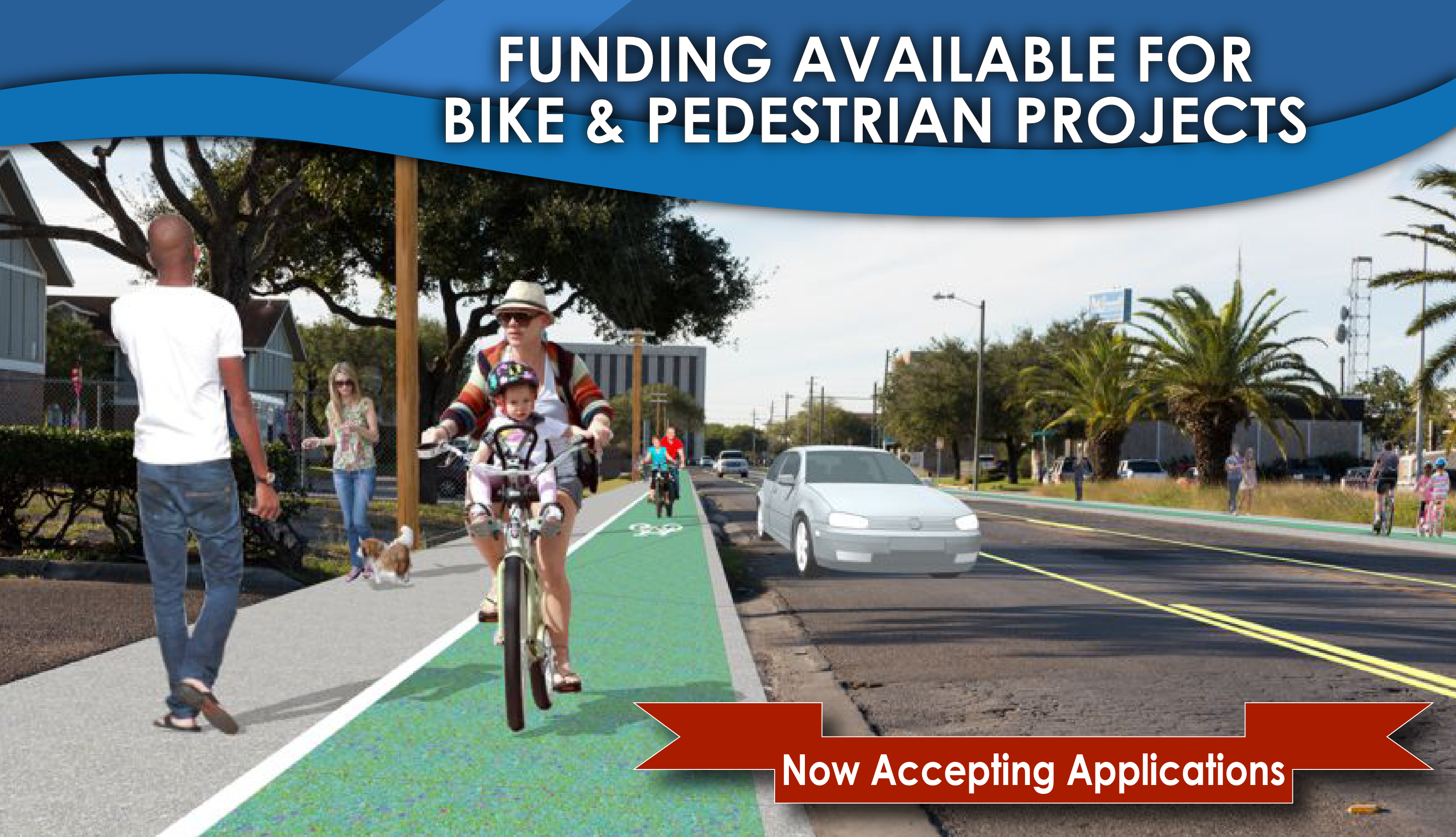
STBG-SA CALL FOR PROJECTS
The Corpus Christi MPO has issued a $6.6 Million Call-for-Projects, covering FY 2027 – 2030 For Bicycle and Pedestrian Projects
STBG-SA CALL FOR PROJECTS INFORMATION PAGE
The Corpus Christi MPO has issued a $6.6 Million Call-for-Projects, covering FY 2027 – 2030 For Bicycle and Pedestrian Projects
STBG-SA CALL FOR PROJECTS INFORMATION PAGE
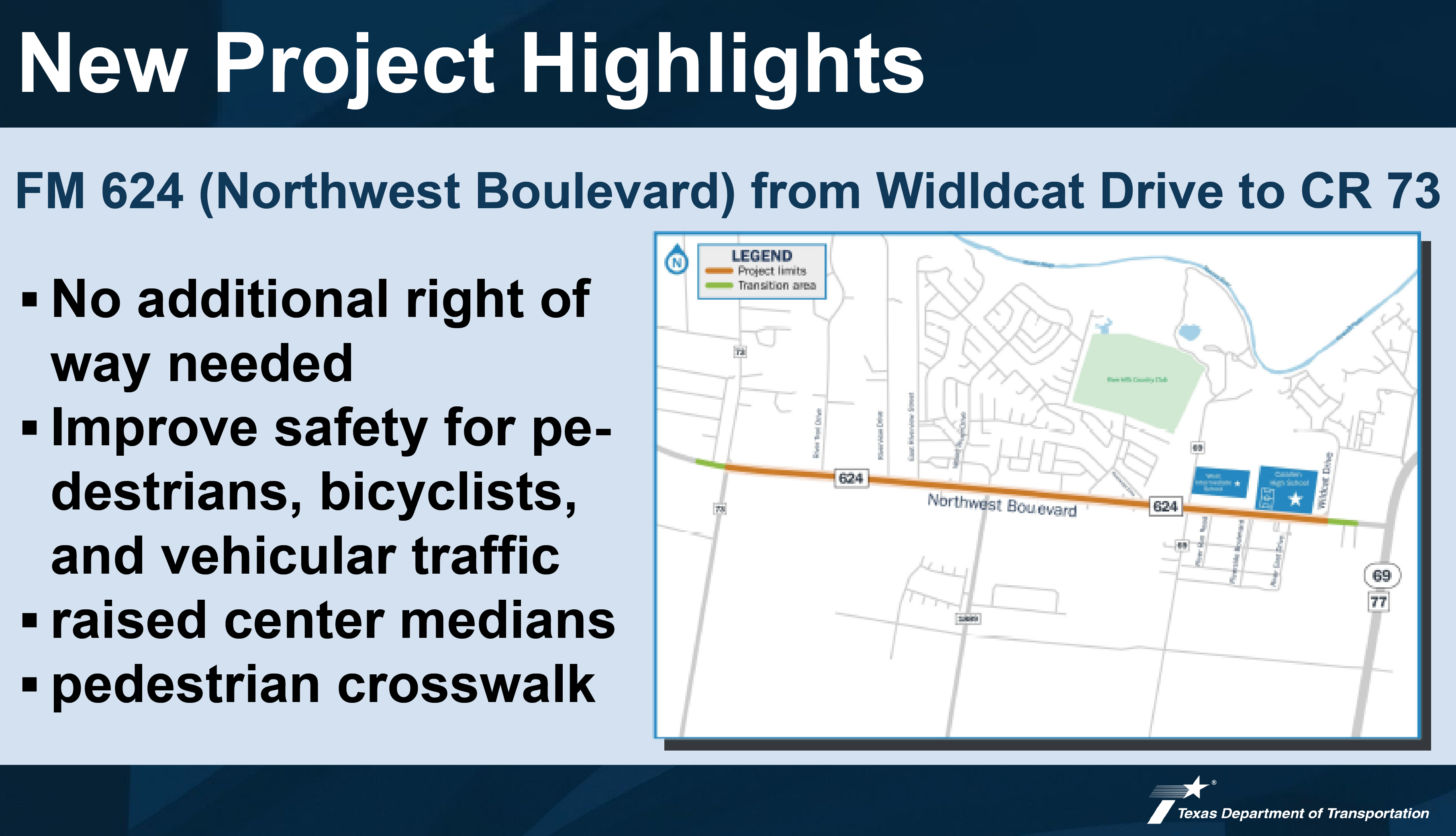
TxDOT is proposing improvements to FM 624 (Northwest Boulevard) from Wildcat Drive to CR 73 in Corpus Christi, Nueces County, a length of approximately 3 miles.
The proposed project would widen the roadway to accommodate three continuous travel lanes in each direction, turn lanes, and a 10-ft shared use path/sidewalk.
NEW PROJECT AT FM 624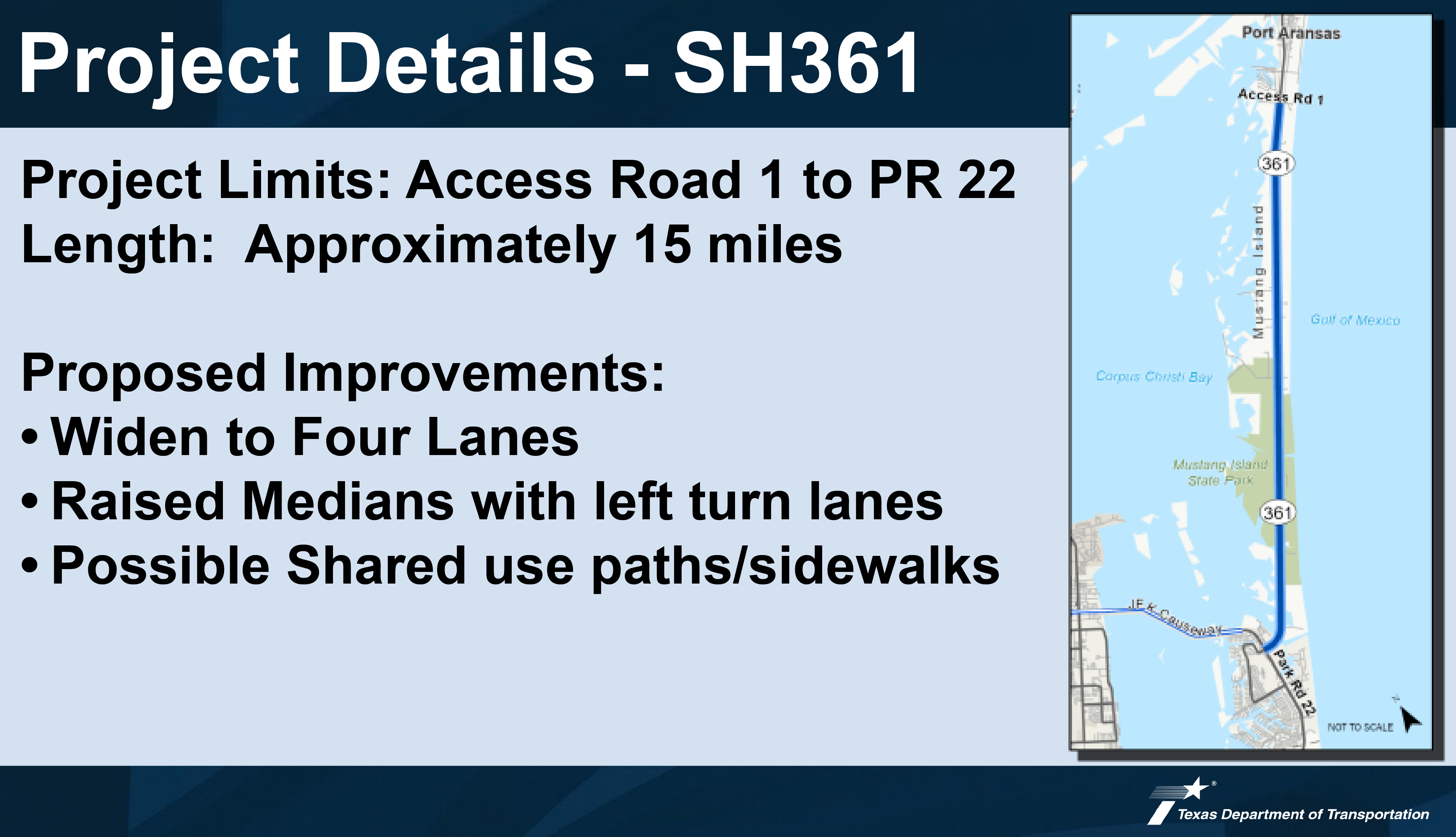
The proposed project would widen SH 361 to a four-lane highway with two travel lanes in each direction,
raised center medians with left turn lanes as needed, and a sidewalk/shared use path.
The proposed project is approximately 15 miles in length and would be designed to improve safety and mobility along SH 361.
SH 361 Mustang Island Project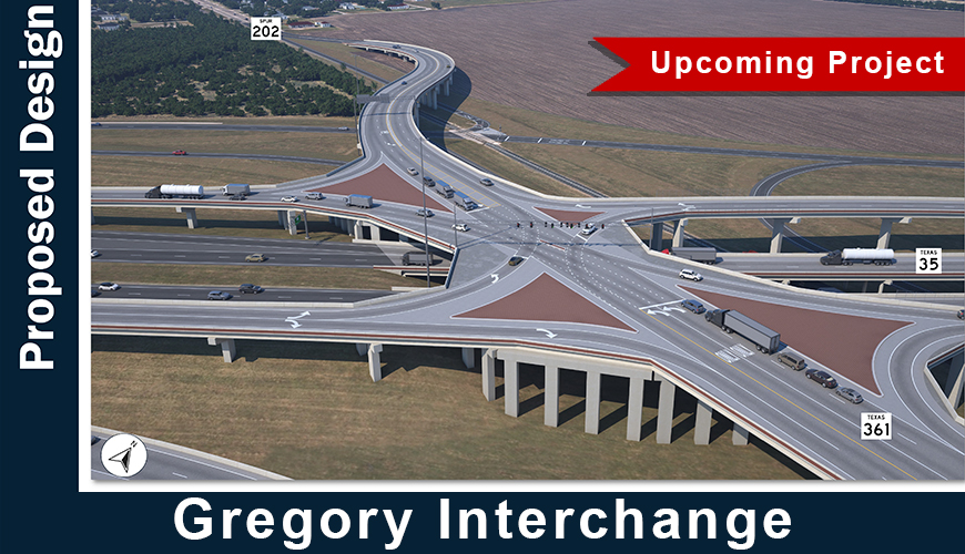
Read about the details of this TxDOT project, known as the SH 35 at SH 361/Spur 202 Interchange.
GREGORY INTERCHANGE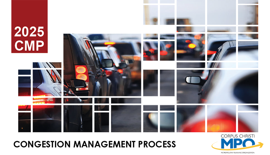
Congestion management is the application of strategies to improve transportation system performance and reliability by reducing the adverse impacts of congestion on the movement of people and goods. The CMP is intended to move these congestion management strategies into the funding and implementation stages. The CMP, approved by the TPC on April 2, 2026, is defined in federal regulation as a systematic process that provides safe and effective management and operation of the multimodal transportation system.
2025 CMP
The MPO region encompasses the cities of Corpus Christi, Portland, and Gregory, along with parts of Nueces and San Patricio Counties. Your input is essential in shaping future transportation plans for the area.
The Corpus Christi MPO seeks your feedback on regional transportation needs and priorities.
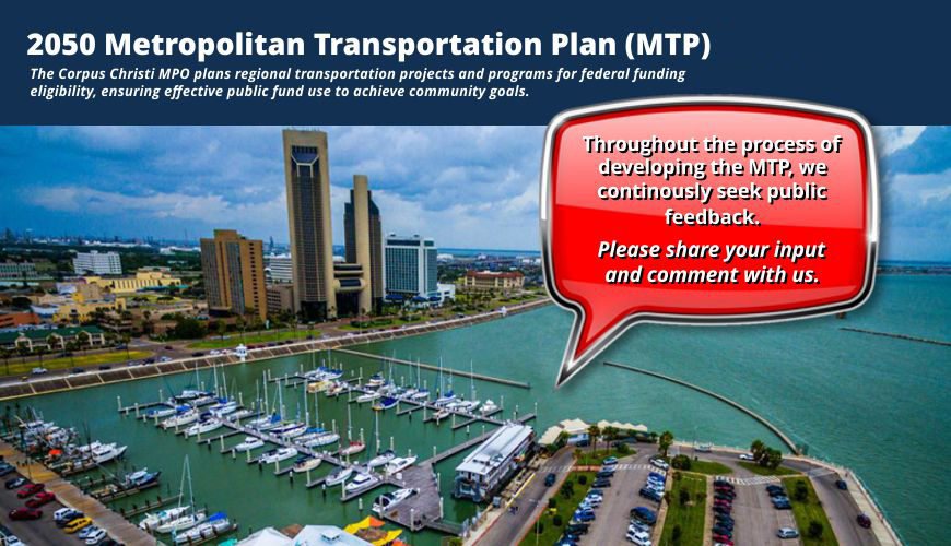
The MTP, updated every 5 years, will steer transportation investments and enhancements in the Corpus Christi region for the next 20 years. To ensure that our plan aligns with the needs and priorities of our vibrant community, we are embarking on extensive public outreach initiatives throughout 2025.
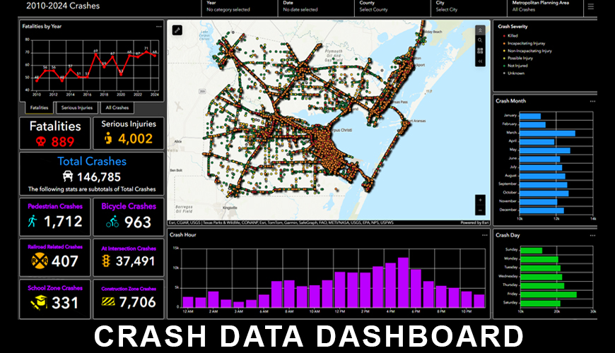
The Corpus Christi MPO Crash Data Dashboard displays crash data in Nueces, San Patricio, and Aransas Counties between 2017 and 2021.
The crash data is categorized by the severity, type, road system, road description, driver condition, human contributing factor, vehicle type, vehicle movement, road condition, lighting, weather, railroad related, school zone, construction zone, and by year, month, day and time.
The Transportation Policy Committee will hold a regular meeting on August 6, 2026 at 2:00 pm CT.
tpc meetingThe Technical Advisory Committee will hold a regular meeting on August 20, 2026, at 9:00 am CT.
tac meetingThe Transportation Policy Committee will hold a regular meeting on September 3, 2026 at 2:00 pm CT.
tpc meetingThe Technical Advisory Committee will hold a regular meeting on September 17, 2026, at 9:00 am CT.
tac meetingThe Transportation Policy Committee will hold a regular meeting on October 1, 2026 at 2:00 pm CT.
tpc meetingThe Technical Advisory Committee will hold a regular meeting on October 15, 2026, at 9:00 am CT.
tac meetingThis report documents the joint Federal Certification Review (FCR) conducted by the Federal Highway Administration (FHWA) and the Federal Transit Administration (FTA) for the Corpus Christi Metropolitan Planning Organization (CCMPO) on October 26-28, 2021.
FEDERAL CERTIFICATION REVIEW: 2021 REPORTThe Active Transportation Plan, which includes the Complete Streets and Micro-Mobility Plan, outlines a shared vision for developing a safe and efficient network of pedestrian and bicycle facilities within the Corpus Christi Metropolitan Planning Area (MPA).
ACTIVE TRANSPORTATION PLANThe Regional Safety Action Plan (RSAP) is designed to supplement and support the Regional Safe System Plan that is being developed as part of the 2050 MTP. In an effort to eliminate roadway fatalities and serious injuries, the Federal Highway Administration (FHWA) enacted the Safe Systems Approach.
REGIONAL SAFETY ACTION PLANThe purpose of the Public Participation Plan (PPP) is to include residents, community and neighborhood groups and associations, non-profit groups, business sector groups, transportation providers, federal, state, and local government agencies, and many others to participate in a proactive, predictable planning effort that provides full access to making key transportation decisions early and throughout the process.
PUBLIC PARTICIPATION PLANAdopted April 2, 2026 - The 2025 Program for Addressing Discrimination (PAD) updates the process the Corpus Christi MPO uses to address Federal requirements of Title VI, Environmental Justice (EJ), Limited English Proficiency (LEP), and Achieving Racial Equity (ARE) concepts, definitions of Title VI and associated nondiscrimination acts.
2025 PROGRAM FOR ADDRESSING DISCRIMINATION (PAD)A Congestion Management Process (CMP) is a methodical and regionally endorsed approach to congestion management. It offers precise, current information on the performance of the transportation system and evaluates alternative strategies to manage congestion in accordance with State and local requirements.
CONGESTION MANAGEMENT PROCESS (CMP)